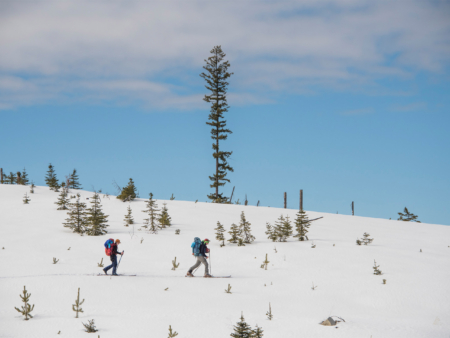
The Worst Traverse
The industrious truth of British Columbia’s forgotten forests.
All photos by Kari Medig
The Okanagan Range in south-central British Columbia is a rolling sea of gentle valleys and low ridges. The mountains there are emblematic of the tightrope that BC walks between story and truth. While the province markets itself as “Super, Natural BC” and “The Best Place on Earth” through grand imagery of unspoiled wilderness, the expansive clear-cuts of the Okanagan Range remain off the public radar. Too low and rolling for serious skiing, the range lacks the visual alpine vista prerequisites for “sexy” mountains.
Yet the Okanagan Range is important to many. It’s part of the traditional territory of the Okanagan Nation Alliance, which includes seven communities in the BC area as well as the Colville Confederated Tribes in northern Washington state. The Syilx People practice forestry in the mountains near Westbank, BC. They are working to reclaim and reinvigorate the land through responsible management that prioritizes long term ecosystem health and the livelihood of local families over corporate profits.
While the Okanagan Valley and its vineyards is a BC marketing gem, neither me, skier Leah Evans or photographer Kari Medig had ever really heard anything about the Okanagan Range, despite living nearby. We knew that there was more to the truth of our home province than the advertised “forest-scapes” and shimmering mountains. The best way for us to experience the real BC was to go deep and immerse ourselves in the land through the timeless pilgrimage of a multiday ski traverse, the pinnacle of a winter wilderness commitment. The Okanagan Range was the perfect destination for what we called “The Worst Traverse.”
From the lakeside town of Peachland, we’d hitch 70 miles north to the village of Falkland, hoping to ski tour back to our vehicles. Along the way we’d seek the industrious truth of BC’s forgotten forests in this lesser-known swath of the province.
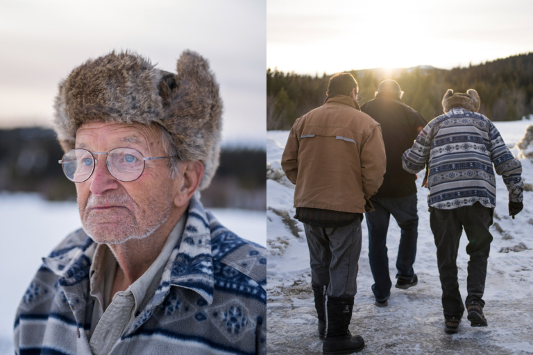
Clarence Fenton has lived on the west shore of Okanagan Lake for all of his 91 years. Through his many decades working in the Okanagan Range, he’s seen much of the surrounding forest reduced to barren cut blocks and local wildlife, both terrestrial and aquatic, diminish in size and numbers.
Ninety-one-year-old Clarence Fenton knows as much about the forests around Peachland as anyone. Fenton grew up in the lakeside community of Glenrosa and was literally the first employee of local forest giant Gorman Brothers Lumber, where he started building apple boxes in 1952. He worked in the forest industry for most of his life and ran a trapline as well as a successful hunting outfitting business in the Trepanier and Peachland Creek watersheds west of Okanagan Lake.
“Back in the day, logging used to be selective,” Fenton says. “You’d pick and choose the best trees to cut and leave the rest, and wildlife had some shelter. Today, all you see is these huge clear-cuts.”
Fenton has seen the land, and the wildlife it supports, change utterly with the building of roads and the removal of the forest.
“We used to catch 8-pound trout in the lakes, now you’re lucky to hook a 2-pounder,” he continues.
Fenton recalls seeing 500 deer on the 14-mile drive from Peachland to Summerland in late winter back in the 1980s. On the way to Peachland, we see one deer on that same stretch.
“There were even grizzly bears in these hills back in the day,” Fenton laments, “but nowadays there are too many people, too many ATVs, too many hunters and not enough places for wildlife to hide.”
Despite the environmental cost of clear-cutting, forestry supports just over 2,700 jobs across the entire Thompson and Okanagan regions, which are home to just under 530,000 people.

Bushwhacking at its worst. Evans and Quinn set out from Peachland, British Columbia, on day one of The Worst Traverse, working their way through dense growth in a recent cut block.
We think of Fenton when we cut through lynx tracks 10 minutes into the traverse. They make us wish for lighter packs and better tread, as hot weather begins to rot out the already shallow snowpack. With each step, we either gather pounds of sticky snow on our skis and skins or, worse, we break through the melting crust like moose—which we start to encounter daily with their noisy, alder-snapping feeding sometimes waking us at night.
On top of the slow going, route finding quickly becomes our biggest challenge. There is not a mountain in sight, and the rounded, rolling hills are deceptively vertiginous. A 2,500-vertical-foot climb or descent always seems to hide 50-foot-high cliff bands or several walls of impenetrable second-growth, forcing detour after delay. Fresh clear-cuts provide easy travel, but our first attempt to shortcut through a thin swath of standing forest nearly ends in disaster when I tumble off one of the countless, head-high blown-down trees and nearly impale myself on the sword of a broken branch. Any standing forest seems to have been left because it was too steep to cut or too full of dead, fallen timber—both of which render travel nearly impossible. Even the open, rotten snow precludes actual skiing. We all cheer if one of us pulls off an improbable turn or two, but the best we can hope for is a long, slow downhill traverse to cover some ground.
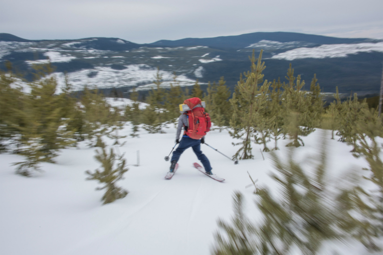
Not your typical backcountry skiing in BC. Evans in survival mode atop breakable crust while descending a logged-then-replanted hillside.
This impassable, logged-off reality forces us many miles out of the way to reach our daily goals. A camp 10 miles away might entail 15–20 miles of slogging to reach it. By day two, we are all exhausted physically and emotionally off-balance from the scale of the destruction we have been travelling through. We are just not covering the distance we need to if we’re going to make it to our potential early exit on Highway 97C, which bisects these mountains, and we can’t even make any turns to take the edge off the suck. We crawl into our frigid tents on night two and consider bailing out. For wilderness lovers, deforestation as far as the eye can see is a brutal, visceral assault on the senses. We ask each other: How did it come to this? How is it even legal for this much forest to be razed in such a short period of time?
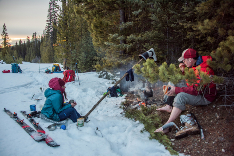
Roadside camping. Snowed-in logging roads provide the easiest travel through the Okanagan Range backcountry. Evans and Quinn settle in and dry out for the evening.
Mic Werstuik, the community and business development officer for Ntityix (the Syilx word for chief salmon) Resources LP is a modern-day Syilx warrior. Werstuik belongs to the Westbank First Nation, wedged between the exploding colonial communities of Peachland and Kelowna. The Syilx People of the Okanagan Nation, to which the Westbank First Nation belongs, signed the Okanagan Nation Declaration in August 1987, asserting that “We are the unconquered aboriginal people of this land … we have never given up our rights to our mother, our mother’s resources, our governments and our religion; we will survive and continue to govern our mother and her resources for the good of all for all time.”
Like most First Nations across Canada, the Syilx have watched truckload after truckload of timber and other resources be removed from their traditional territory, with very little benefit to them or even consultation.
“Westbank First Nation members have a long history of forestry work,” explains Werstuik, “but band members always had to leave their families for up to six months of the year to find work. Why should I leave my family to do my work? Trees grow as well if not better right here in the Okanagan.”
After decades of failed negotiations with the province regarding accessing forest resources for local benefit, Werstuik found himself at the head of a ground-breaking decision. If the resources were not offered, the Nation would have to take them back.
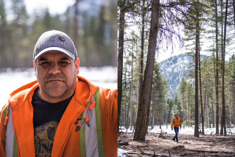
Mic Werstuik, the community and business development officer for Ntityix Resources LP, on a selectively logged cut-block in the Peachland watershed.
“We basically preempted an existing BC Timber Sales Cut Permit,” he says, “and went out and logged one block. The Province of British Columbia immediately issued a stop-work order. We still have the ‘Stop Work $2,000 Fine’ signs on the office wall.”
A 1997 Supreme Court of Canada decision from the Delgamuukw case upheld First Nations’ legal right to access resources within their traditional territory. Judges ordered the Province of BC to do what it legally was supposed to be doing all along: sit at the table and find ways for First Nations to have input on and benefit from industrial activities in their traditional territories.
After three years of difficult negotiations with local timber giants Tolko Industries and Gorman Brothers Lumber, Ntityix, with Werstuik at the helm and the help of registered professional forester David Gill, now manages over 60,000 hectares (nearly 150,000 acres) of forest land with a 150-year logging plan, instead of the five-year plans typical in the BC forest industry.
Before our ski tour, Werstuik and Gill took us to visit a recent Ntityix cut-block that was almost unrecognizable to the untrained eye. A few skid roads and stumps were visible in what otherwise would simply be called a forest.
“We lost money on this block,” explained Werstuik. “We just cut sick trees, creating a more open forest that is better for wildlife than the original thick stand.”
As if on cue, a dozen mule deer pronged through the forest. Pursuing sustainable forestry, Ntityix is even undertaking unheard-of forest management practices in BC, like planting cedar and western white pine based on climate-change-forecast models that predict wetter, warmer conditions in the Okanagan. They’re also planting huckleberry shrubs in cut areas to feed bears and community members alike, as well as monitoring areas pre- and post-tree harvest with game cameras to see what they can do better.
Ntityix’s long-term goals go beyond profits. They want what a well-managed forest can offer: jobs for their people amidst an ecosystem that still supports wildlife that, in turn, keeps the entire system healthy and whole.
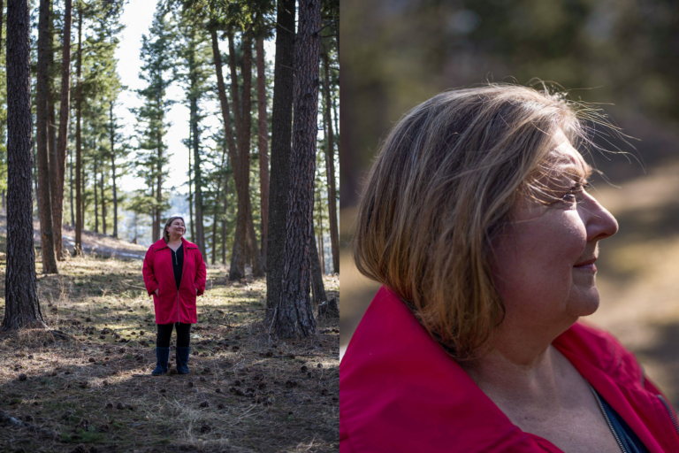
Activist Taryn Skalbania of the Peachland Watershed Protection Alliance near her home in Peachland, BC.
The Syilx are not the only ones demanding forestry reform in the Okanagan. Peachland Watershed Protection Alliance (PWPA) farmer-activist Taryn Skalbania praises the shift from what she calls the “timber cartels,” like Tolko Industries and Gorman Brother Lumber, to Ntityix. Skalbania was shocked when she moved to Peachland in 1990 to see sprawling clear-cuts, an open-pit copper molybdenum mine and nearly 1,500 cows ranging through the drinking watersheds of her new home. With bathwater at times running green, months-long boil-water advisories and no relief in sight from continued clear-cutting in their watersheds, Skalbania and others formed PWPA in 2016.
“The way the BC laws are written, industry simply has to leave water in a state that could be treated to render it fit for human consumption,” explains Skalbania. “So, we get to stand by and watch hundreds of acres of clear-cuts sprawl across our watershed every year, then spend $24 million as community taxpayers to treat the resulting damage to our drinking water.”
Skalbania, who volunteers upward of 40 hours a week maintaining a superhuman effort to change water policy in British Columbia, is also actively engaged with over 70 local watershed groups from across BC whose goal is to elevate water quality, not industrial activity, as the main target for community watershed management.
“Citizens need all kinds of permits and no-trace principals in order to build a trail in a community watershed,” she says. “Meanwhile, industry is in there with cattle, fences, mine buildings, tailings ponds, and roads and clear-cuts for logging. Most of these can certainly be done better than they currently are, and many of these activities simply cannot be done in a community drinking watershed, if your primary goal is good water.”
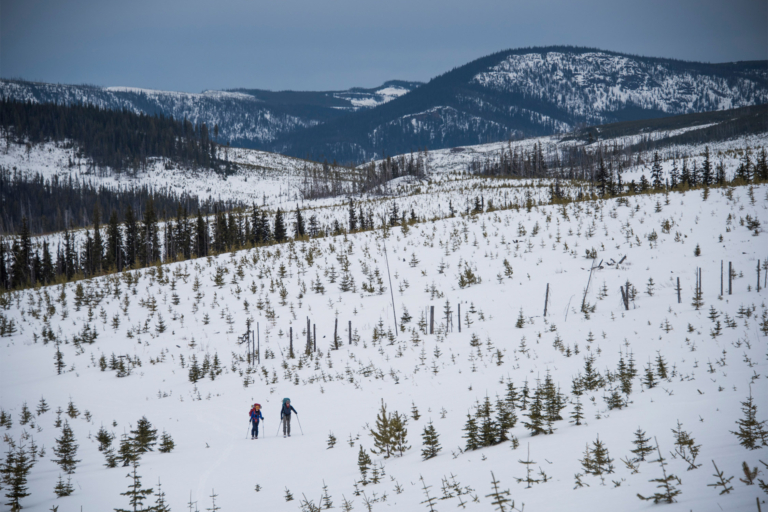
Evans and Quinn have spent most of their skiing lives pursuing steep lines in deep snow. Here, they slog through the bleak landscape of the logged-out Okanagan Range, which comprises the northeastern-most reaches of the Cascades.
Back on The Worst Traverse, our 70-mile route takes us through a token 1,000 yards of intact, old-growth forest. Roughly halfway through the trip, we gamble on a shortcut across a ridge between recent clear-cuts and find an oasis of gorgeous, towering, lichen-draped spruce trees sheltering an open and inviting understory of smaller trees and shrubs. This old-growth forest island reminds us why we love ski touring. Here, we have reason to pause, look around and let the beauty of the world recharge us for the next climb.
But even this tiny island on a forgotten ridgeline has bright flagging tape flapping in the wind, advertising its impending clear-cut. While moose seem well adapted to the surrounding liquidation of beauty, what of the woodpeckers, flying squirrels, fishers, owls or caribou, all of whom require intact older forests for everything from making dens to lichen production? What of the legal rights of the Syilx to access and control resources on their traditional lands? And what of the water, that most precious resource for all, that starts its journey back to the sea in this ridgetop sanctuary?
We push on for two more grueling days, but in the end, The Worst Traverse lives up to its name. Faced with nothing but miles of fresh clear-cuts and crappy snow, we bail out early from this logged-off wasteland. Our time in the Okanagan Range has confirmed the truth: large swaths of British Columbia are closer to “Super, Clear-Cut” than “Super, Natural.”
Hope lies in a future where forests are managed by groups like Ntityix, where people, wildlife and water are the main drivers of forest management policy, not profits.
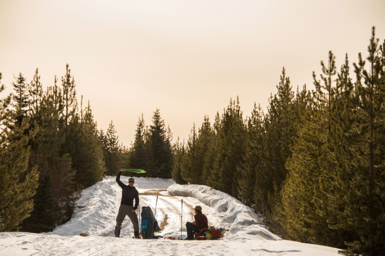
A moment of glory next to a plowed road at the end of the traverse. The caretaker at a nearby lakeside lodge offered a lift back to the highway, for the long hitchhike back to their vehicles.
