Suffering for Solitude
The rumble of the diesel engine fades out of earshot, giving way to our new solitude: Just us, the frozen river, our kayaks (fully loaded with ski mountaineering gear, camping supplies, rations for five people and all the needed accoutrement for 18 days in the Boundary Range) and hundreds upon hundreds of uninhabited miles of northern British Columbia wilderness. One hundred and fifty miles of the Stikine|Shtax’héen River and the Stikine|Shtax’héen Ice Cap lie ahead.
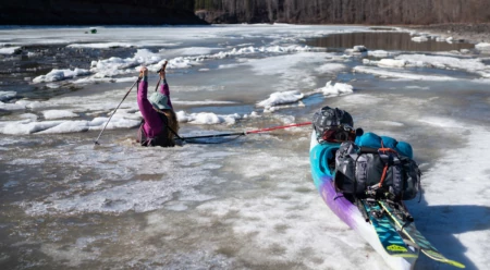
We’re kayaking the length of the lower Stikine| Shtax’héen, from Telegraph Creek to Wrangell, Alaska, to access the high alpine neighboring the river and to ski some of the peaks along the way. Getting our 300-pound sea kayaks over deteriorating ice to the open flowing waters of the river is our first obstacle. Once past the sketchy ice near the shore, our vessels slide easily over the frozen river. After less than a mile of towing our kayaks, we hit the first patch of open water and start paddling downstream.
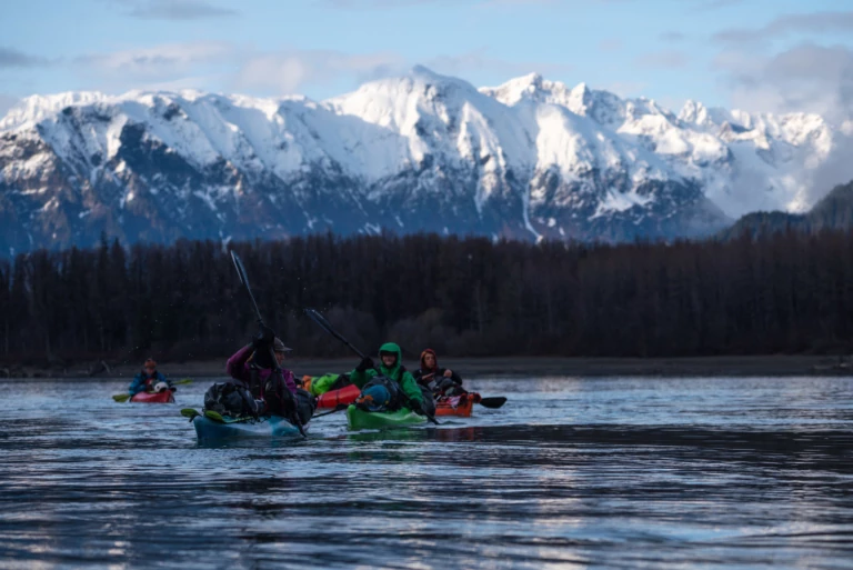
Daylight fades quickly after a stop at a local fish biology camp, where the occupants supplied a steady stream of beer and whiskey. The crew’s goal of making it to the hot springs quickly faded with each beer, so we pitched camp closer, in what we’d later discover is a well-known area for grizzlies. Photo: Jasper Gibson
Throughout the first day, navigating intermittent patches of ice and switching from towing our kayaks to paddling routinely halts our progress; the going is slow, but honest. The light of day starts to flicker, and we decide to look for our first camp. As we round the last river bend of the evening, our eyes fixate on a wall of jagged granite peaks looming in the distance, guarding the entrance to the mountains that we plan to transect.
The Stikine is known as Shtax’héen in Tlingit, the language of the lower watershed people who traveled upriver for berries and salmon and to trade with the Tahltan of the Upper Stikine—both sustained themselves alongside these waters for centuries. The upper watershed is central to the cultural, spiritual, and subsistence practices of the Tahltan First Nation, and is part of the Sacred Headwaters, where four great rivers originate – Stikine, Skeena, Finlay, and Nass. We ask for passage (and, hopefully, some epic skiing) through their home. Brendan Wells (videographer), Katrina Van Wijk (lady crusher and all-around badass), Erik Johnson (trip leader, organizer and motivator), Kent Christensen (the best skier of us all, and token humble man) and I ask to be written into the river’s story.
The aroma of coffee wafts into the chilly morning air, rousing us out of our sleeping bags. Two hours later, boats packed and bellies full, we don our dry gear and set off across a treacherous section of ice, each of us breaking through at one point or another. Luckily, a lower ice shelf keeps us from becoming fully submerged in the 38 degree, hypothermia-inducing waters. After an hour of struggling to cross this quarter-mile section, we hit open water, signaling the last time we would traverse ice for the rest of the trip. That obstacle behind us, a relentless headwind impedes our downstream progress, making the miles long and laborious.
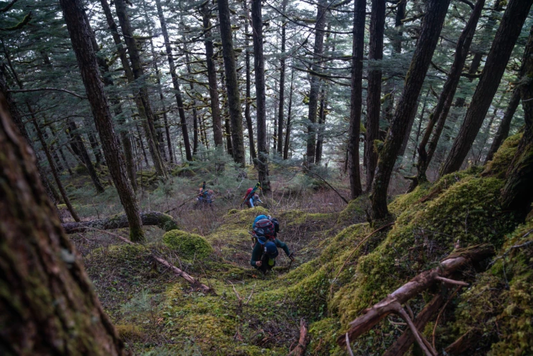
Ascents into the Stikine|Shtax’héen alpine are rarely straightforward. Frozen turf, old-growth forests, slide alder, technical skinning and steep terrain make just getting to the skiing a beast. Photo: Jasper Gibson
On day two, thanks to a steady tailwind, the miles quickly add up as the scenery whizzes by: the dry rolling grassland of the high tundra transforming into progressively more staggering peaks. Our skiers’ minds go haywire, imagining the steep skiing possibilities that hide behind every river bend. Discussing the seemingly endless options, we decide to continue downstream, hoping the snow line will reach the river and make access to the alpine much easier. A snow-covered island with scrubby alders becomes our home for the night. Day three will be our first push into the alpine.
Our morning erupts in a ball of fire—the twigs and white gas Johnson has just ignited while starting a warming meal. It’s 5:30 a.m. The first rays of light shine upon the high peaks as we down coffee and oatmeal before clicking into our skis and schlepping our heavy bags filled with avalanche gear, ropes, harnesses, crampons, axes, camping equipment and three days’ worth of food onto our backs.
The flat frozen streambeds that lead us out of camp make for easy, efficient skinning. After two river crossings–one requiring a full ski boots and socks striptease–we start up through the hellfuckery of the slide alder forests above. We pull, crawl and scratch our way through 500 vertical feet of steep slide alder and reach a gorgeous old-growth forest with minimal understory and even less snow. Shouldering our skis, we bootpack up through the frozen forest, which gets steeper with every step. We dub the ascent ‟forestineering,” a mountaineering varietal in the thick of the woods; the best tool for the job, a whippet. With whippets in hand, sometimes gently, yet often rather aggressively, we hook the trees and get good ‟sticks” into the frozen turf. Eventually, the steep forest opens to the alpine and, once again, skinning becomes a much easier endeavor.
Looking for a spot to carve out our alpine base camp, we find a shelf on the sheltered leeward side of a slope. We pitch tents, build a kitchen and whip up a well-earned meal, while the evening glows with pastel hues. And then comes bed, while the light still lingers in the sky.
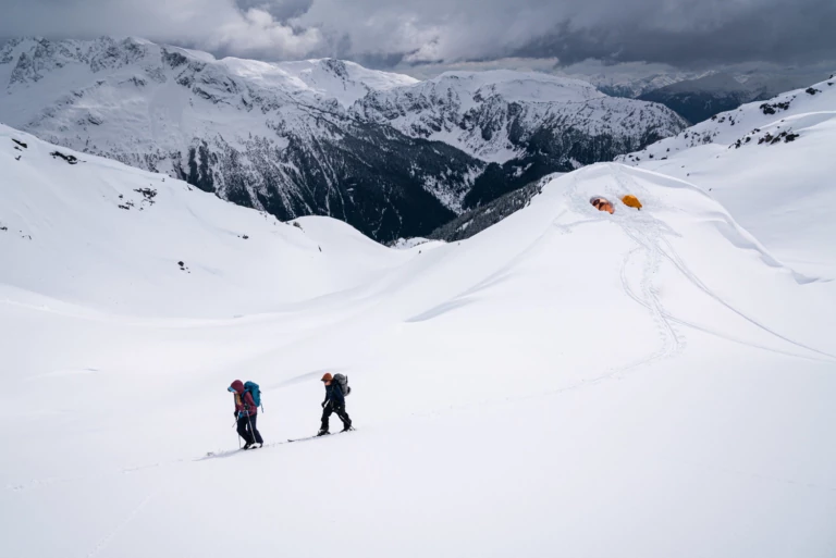
Katrina Van Wijk and Kent Christensen skinning from the second alpine base camp. Touchy snowpack and a full-on winter storm keep the group from skiing lines in the area. Photo: Jasper Gibson
Brendan peels back the tent door. A five-inch dusting is fresh on the surrounding peaks, and a mute grey river of clouds hangs above the Stikine|Shtax’héen. We choose a 2,000-foot north-facing ramp on the west ridge of Mount Scotsimpson. Feeling light with our small packs, we travel straight toward our objective, picking our way along the ridgeline. But we need to pass a steep 400-foot face to access Scotsimpson, so Johnson and Christensen dig a pit and analyze the snowpack. Their results are comforting. We summit the little knob. Kent makes some beautiful GS turns down the face and rockets through the steep pinch. Johnson is next with an elegant descent, followed by me, Katrina, and finally Brendan.
A quick ski traverse takes us to the base of a looming ramp, so we slap crampons on our feet, skis on our backs and start up. Erik and Kent swap leads the whole way, postholing the fresh snow up to their thighs and setting the bootpack for the rest of us who are lagging. The ramp grows progressively steeper with the last 100 feet really kicked back, turning into steep snow climbing. Erik and Kent debate about pushing on and decide to go for it. Johnson confidently makes his way up the 60-degree hollow snowpack, which is littered with hidden rocks and has the potential for a 2,000-foot fall. He passes the headwall and makes an expert high-foot-move to gain the summit. Kent quickly follows. The two set up an anchor and lower a rope for the rest of us.
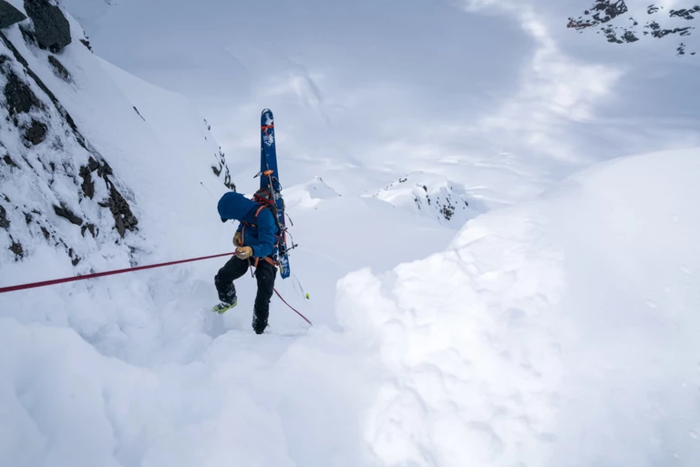
Mistakes aren’t an option when rescue is not guaranteed and your partners are your lifeline. Many miles from anywhere, Erik Johnson rappels into the “Mount Dang Couloir” on Mount Scotsimpson with thousands of feet of exposure below. Photo: Jasper Gibson
Once everybody makes the summit, we sling an exposed rock horn, throw a carabiner on it and rappel back into the top of the line. It is steep, 55 to 60 degrees, with thousands of feet of mountain below. Johnson had dreamed about this line for four years, so it is only right that he skis it first. He drops in, making effortless turns down the freshly covered ramp, blowing up clouds of cold smoke with the wide, winding Stikine|Shtax’héen River in the backdrop. His line is an unnecessary but fun claim on the first descent that he calls the “Mount Dang Couloir.” One by one, the rest of the crew skis down the ramp. High fives, bellows of joy and hugs are the reward at the bottom of the line. Our conclusion: It was one of the better lines—if not the best—that any of us have ever skied.
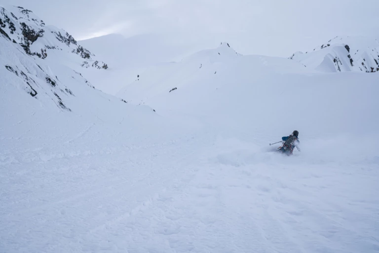
The line on his mind. Just a few days into the expedition, Erik Johnson claims the first descent on the “Mount Dang Couloir,” after years of visualizing it and months of planning. Photo: Jasper Gibson
We stick to low-angle pow skiing the next day, and the following morning pack up camp and descend through the steep dense forests as the rain pours. Back at our river base camp, we dry our sopping gear and hit the sack after nightfall. Morning comes and 20 miles of paddling graces us with warm springs and a massive spruce tree as shelter from the intermittent showers so characteristic of the Stikine|Shtax’héen. We soak our cold, sore bones in handmade lukewarm pools.
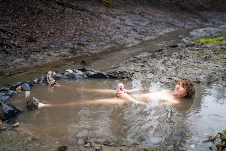
Nothing like a little vitamin R and a handmade, muddy, warm pool to soak in after a grueling mission in the alpine. Erik Johnson reveling in Stikine|Shtax’héen leisure time. Photo: Jasper Gibson
The next days include schlepping, schwacking, billygoating, straightlining, tent pitching—and an avalanche. Digging a pit reveals reactive layers and the group confers about skiing the surrounding drool-inducing couloirs. Hangfire releases off a cliff downhill from us and starts an avalanche that brings us right back down to Stikine’s|Shtax’héen earth. This convinces us to bail on skiing that aspect. We flip around and ski back down to camp for the night, hoping that the snowpack will settle and that tomorrow’s weather will cooperate. Instead we wake to a blistering sheet of wind and snow relentlessly smacking our tent walls as an approaching storm makes its presence known. Katrina grabs her inReach and sends a request for a weather update. The forecast calls for heavy precipitation and piercing winds for the foreseeable future. We won’t ski the rest of the trip. But the trip continues with mystical hot springs, generous locals, fresh fish, gargantuan glaciers, campsites in dense grizzly territory, encounters with a sea lion and hunting for garnets.
Author’s note: The Stikine|Shtax’héen River watershed is being threatened by the proposed Galore Creek Mine. The mining project, which would be located only four miles from the ramp we skied on Mount Scotsimpson, has received all its environmental permits and is currently awaiting adequate financing to proceed. If the proposed mine is developed as planned, it will be one of the world’s largest open-pit mines and will cause irreparable damage to the headwaters of the Stikine|Shtax’héen and Iskut Rivers. The health and well-being of downstream communities, the salmon fisheries and the water quality of the Stikine are all under direct threat from this nearsighted mine proposal, which will benefit only the mining companies, investors and select individuals.
Please check out www.seacc.org/stikine to learn more and get involved.
