Ryland Bell’s Chilkat Hideaway
Predawn on April 4, 2019. There’s hardly any snow in the mountains. Worst year in recent history, the locals are saying. We’re loading boxes of food onto the ferry, preparing to board the Alaska Marine Highway from Juneau to Haines.
“It’s southeast Alaska, you never know,” Ryland Bell says. “It might rain for 90 days straight.”
The cruise to Haines takes five hours up the Lynn Canal, home to sea lions and porpoises and large salmon runs. The mountains rise straight from the ocean, obscured by clouds, ripped by wind. Halfway through, it begins to snow.
Ryland has a house 26 miles up the Chilkat Valley from Haines. He spends his spring there chasing big lines, his summers running his hook and line fishing vessel out of nearby Elfin Cove. Born and raised in the Alaskan interior hub of Fairbanks, Ryland moved southeast to engage with real mountains in his late teens and became one of the best big mountain riders in the world. Now spending the bulk of his winters in Tahoe, Ryland reached his status as a master of the steeps by riding every day, no matter the conditions, trying to emulate what he’d seen from Tom Burt, Johan Oloffson, The Hatchett brothers, Jim Rippey and so many other stars of the 90’s-era Totally Board series by Standard Films. Snow or no snow we’ll be boarding a lot on this trip.
“Lynn Canal is technically a fjord, because glaciers run into it,” Ryland explains. “They don’t want to classify it as that though, because they use it for shipping.”
Ryland knows and loves this land. He’s a second-generation fisherman who relies on healthy salmon runs to keep his big mountain dreams rolling. And as I’ll learn, the Chilkat’s piscine population is under threat from the proposed Palmer Project mine near its headwaters.
“The rest of the season’s just training for this,” Ryland says as we near Haines harbor. “If I have to sit in the rain for a month to get one good day in Haines, it’s worth it.”
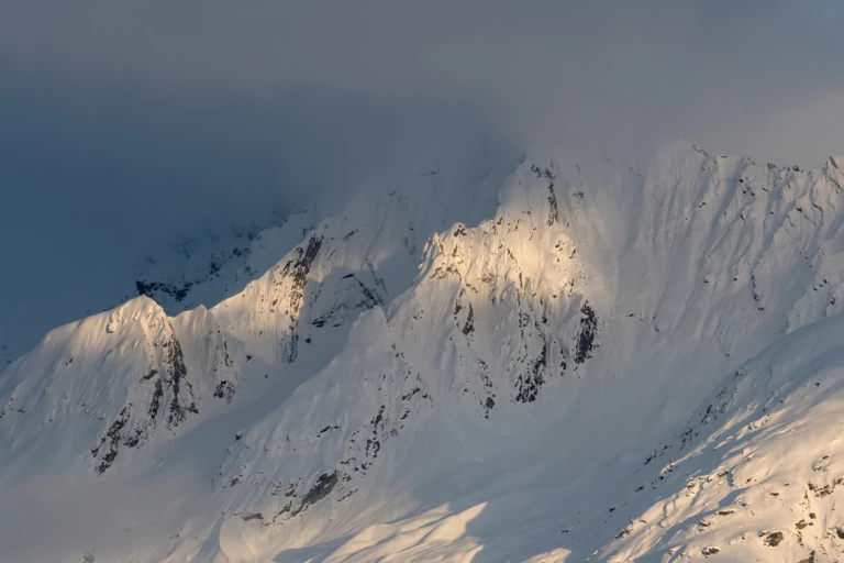
Last light on the Chilkats after a long day of snowboarding. These peaks sit somewhere near the border of Alaska and British Columbia and, with enough snow and stable conditions, offer numerous dream lines. They also feed the Chilkat River, which is under threat by the Palmer Project, a proposed high sulfide zinc and copper mine that is in the advanced exploration stage. Photo: Colin Wiseman
Haines is quiet. The proprietor of the local Thai restaurant claims she’s only seen four skiers this year. We drive to Ryland’s house in his early 2000’s Toyota pickup. Pulling down a gravel road, we turn into a muddy driveway, pass an open-air garage with six snow machines inside, then the composting toilet, and park.
Ryland shares his rustic cabin with his brother Taiga, also a fisherman. A two-story box heated by a wood stove and operating on propane, the shower sits in the kitchen atop plywood floors. Racks on the walls hold backcountry gear: harnesses, ropes, ice axes, etc. Upstairs, in the loft bedroom, more piles of gear are loosely organized and ready for long days in the mountains. There’s a small TV with a full library of snow films and magazines for entertainment.
We step outside and hear the crack of a semi-automatic rifle through thick alder. Cell phones don’t really work out here. Ryland’s got a rotary land line. It’s somewhat lawless here, back of beyond, and free.
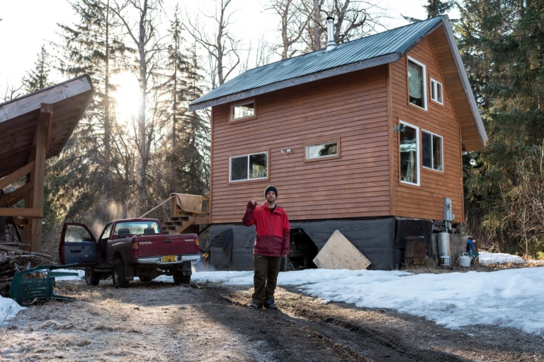
Bell in front of his cabin at 26 mile outside of Haines, AK. The simple two-story structure features an outhouse, a wood stove for heat, a propane stove for cooking, and an on-demand shower that sits in the kitchen. Photo: Colin Wiseman
“I think there’s a brown bear up there,” Charles Peep says over the radio.
Charles is one of Ryland’s best friends. He too is a fisherman and lives in Haines. They grew up together in Fairbanks. A couple days into the trip, we’ve driven northwest in Charles’ aged white Tundra with a shattered windshield, and made our way across the border into northern British Columbia. The day prior had yielded three inches of dust on crust and poor weather closer to home—we’re hoping the glaciers up high have better snow.
But there’s that grizzly bear problem. We hadn’t been able to access the glacier due to lingering clouds, so Charles and Ryland decided to investigate an odd-looking stack of 15-or-so sequential windlips rolling down a ridge. They were at the bottom, just starting to hike, when they saw the ursus arctos horribilis at the top of their line.
“Looks like it’s headed uphill,” I reply, from a very safe distance. “I’ll let you know if it turns around.”
The pair presses on and the newly awakened grizz lumbers up and over the ridge and out of sight, granting them access to the first turns of the trip. We call it the Bear Stairs and it rides like shit. But the sun clears, so we head to the high country, and, after a few quick runs on the glacier to assess snow conditions, the pair boots up a steep ramp. Intermittent clouds break long enough to drop in. The turns are good—an open, steep face with a foot of fresh on top of old, consolidated snow. The worst year ever in Haines is still better than the best year in some lower 48 locales. And it looks like more snow is coming.
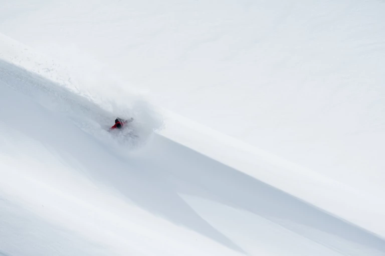
Ryland Bell warms up with a backside slash in northwestern BC, not far from his home in Haines, AK, in early April. These quick and easy windlip laps were a great way to assess conditions as the first storm in months started to drop some snow in the alpine. It only got better as the days went on. Photo: Colin Wiseman
We settle into a routine: up to Canada in the morning, head to the glacier, wait for light. Every day, there are a few hours of sun—enough to get up high.
“Spend a week up here and you’ll get a full day of sun,” Charles jokes.
We’ve hardly seen another soul, except for the Quebecois couple who have set up shop in a rudimentary warming hut beside the highway. A foot of fresh turns into two, then three, then increasing avalanche danger with each daily dose of precipitation. This first storm since December brings hope, but also a heightened sense of caution.
Driving home on the fourth afternoon of our now-daily international sojourn, Ryland starts talking mountains. He begins by pointing out famous lines on the AK/BC border, then draws my attention lower.
“That’s where they want to put the mine,” he says, pointing to the foot of a massive glacier. “It could ruin everything. At the very least it’ll mean we can’t ride the epic run coming down that ridge for 5,000 vertical feet. But it has the potential to kill the Chilkat salmon run. I don’t know why people support it—even some fishermen are backing the project. They think it will bring more jobs, but what kind of jobs will there be if there aren’t any fish?”
The Palmer Project, being developed by Constantine North Inc., is a proposed high sulfide zinc and copper mine. It poses a serious threat to the Chilkat ecosystem, which supports healthy returns of all five species of Pacific salmon, along with the greatest concentration of bald eagles on the planet, and the highest biodiversity of any area in Alaska. I later speak with Jessica Plachta of Lynn Canal Conservation about the proposed mine.
“The biggest danger from the Palmer Project is acid mine drainage,” Plachta says. “The Palmer Project is a high sulfide deposit, and as soon as the ore is mined out and reaches the surface, contacting air and water, it undergoes a chemical reaction producing sulfuric acid. The sulfuric acid leaches toxic heavy metals from the surrounding rock, which are washed downstream, contaminating the watershed. Even trace amounts of certain heavy metals can be deadly to aquatic life, including salmon. The mine runoff water can be hundreds of times more acidic than battery acid, and the leftover tailings stay toxic for hundreds or thousands of years.”
Then there’s the haul route along the Chilkat river and the threat of truck spills and the poor track record of other sulfide mines with regards to their impact on nearby salmon runs.
“Most local people are increasingly opposed to the project,” Plachta continues. “But, unfortunately, the Alaska State agencies are very permissive to mining industries—they’ve never once denied a mining permit to protect other interests. Ninety percent of local people subsist on the salmon they catch in these waters. Our two biggest economic drivers are commercial fishing and nature-based tourism. Nearly everyone depends on clean water and healthy salmon for their jobs, as well as for their food supply. The tribal leadership of Klukwan (officially the Chilkat Indian Village) came out in opposition to the mine early on and has consistently advocated for protecting the river and the salmon and the other living things that depend on the salmon.”
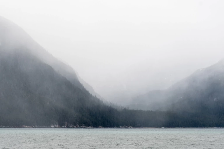
Misty mountains in the Lynn Canal as seen from the Alaskan Marine Highway between Juneau and Haines, AK. Proposed budget cuts could lead to privatization of the Alaska ferry system, which is a lifeline for numerous coastal communities, and the tourism they depend upon. Photo: Colin Wiseman
With social, cultural and environmental concerns paramount in the development of the Palmer Project, why then is it still moving forward?
Plachta again: “Constantine is out hustling investors for more funding. If we can get the word out, widespread opposition to the Palmer Project can undermine the social license for the project and convince investors that the Palmer Project is not a safe, lucrative, or ethical investment. The project may also fail because it is such a bad idea.”
A bad idea because they would need to drill through two faults in a region with high seismic activity, potentially releasing a lot of water that would contact acidic rock then flow downstream into currently pristine waters. A bad idea because they would have to run power to the site then use a public roadway to transport the toxic metal concentrates on winter roads. A bad idea because there is no deep-water port at the end of that road, and nowhere for a few hundred incoming employees to live. A bad idea because the tunnel entrance and waste storage site would sit beneath the toe of a glacier at the base of multiple avalanche chutes in a region that receives 35-40 feet of snow, annually.
Ryland turns onto the bridge across the Chilkat a couple minutes from home. He stops at a sign, explaining that the road we are on was once part of the Dalton Trail, used heavily during the gold rush of the early 1900s. Indeed, much of the early infrastructure in this area was built for mining. It makes me wonder: Can Alaska move past its extractive history and instead recognize and preserve those rich natural resources, like salmon, that can be sustainably managed for future generations to enjoy?
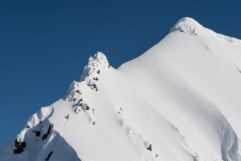
Ryland Bell approaches the crux move on a committing ascent in Northwestern British Columbia. It took several days of riding then several hours of hiking to feel out the snowpack and send this one with confidence. On this day, Ryland, his brother Taiga, and friend Charles Peep rode a few lines off the ridge below this peak. Then, Ryland set an exposed bootpack to the top and dropped in just before the clouds closed in once again. Photo: Colin Wiseman
We wake up at 6 a.m. to clearing skies. Ryland is cooking bacon with reggae blaring: Earth Crisis by Steel Pulse.
“The music’s on shuffle,” Ryland says. “You’re either gonna get reggae or heavy metal.”
Today feels like a heavy metal day. We’ve put in nearly a week exploring a single basin, eyeing up options, testing the snowpack. Taiga has just arrived and is frothing for turns. There’s three feet of fresh up high.
Upon the glacier we begin cautiously, remote triggering a slide on a small slope, confirming suspicions that northerly aspects are a no-go. We move to the southwest facing zone we’ve been riding most of the trip and set our sights higher. The crew tags three small chutes and stability seems good. We begin climbing. A group of high school students arrive and follow their instructor over a windlip air on the glacier below. Seems the good weather has brought out a few more folks.
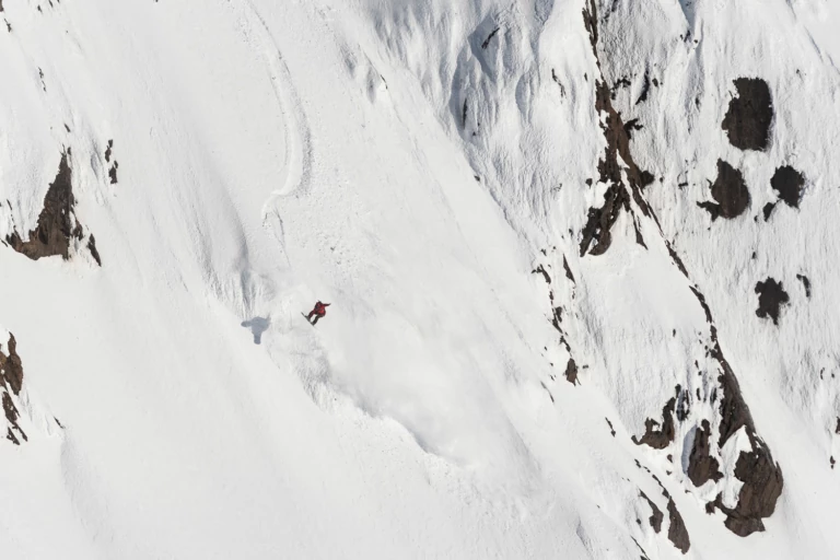
Ryland Bell airs out of the choke nearing the bottom of a 1,500-vertical-foot face in Northwestern British Columbia. He’d been eyeing this face all week, but the weather and snowpack had yet to line up. After a long and committing ascent, he rode the line fast and clean—classic Ryland. Photo: Colin Wiseman
I stay on a ridge while Ryland begins punching a bootpack over increasing exposure, aiming for the tallest peak around, now 1,500 vertical feet above. He hugs the ridge, staying away from the corniced north side, kicking steps through rotten snow between rocks. Wind whips from the east and clouds begin to build to the west. Taiga and Charles follow Ryland to the crux, then stop. He’ll make the final move by himself, then hike another 20 minutes to the summit.
Topping out, Ryland pauses to catch his breath. It’s 6 p.m. and we’ve been out in the mountains all day. Below him lays a wide-open, 45-degree ramp that filters down into a choke with an air out the bottom.
Ryland grabs his radio. “The hardest part is always talking yourself into taking that next step,” he chuckles.
Then he puts his radio away and drops in.
Read more about the Palmer Project, and how you can take action.
While the turns in the hanging bowl above were good, the exit was the highlight of this rarely ridden notch off an unnamed ridge in Northwestern British Columbia. Ryland Bell at speed out the bottom. Photo: Colin Wiseman
