A Pedal Through the Prairie
A bikepacking expedition inspired by one of North America’s most iconic landscapes, and the American Prairie Reserve’s audacious effort to restore it.
The vast prairies east of the Rockies occupy a strange space in the American consciousness. For some, they’re defined by nostalgic cowboy tropes and the Old West; for others, endless, purely functional fields of wheat or soybeans come to mind.
For most, however, they’re perceived as a whole lot of nothing.
Just 200 years ago, the Great Plains—a landscape now commonly referred to as “flyover country”—was one of the biological wonders of the world. Meriwether Lewis, William Clark, John James Audubon and Walt Whitman heaped it with ecstatic praise. Stretching from the Mississippi River to the Rocky Mountains and from Saskatchewan to Texas, the plains were home to 25 million bison, 15 million pronghorn, billions of waterfowl and at least 100,000 grizzly bears (grizzlies were only exiled into mountainous regions in recent human history). Mountain lions and wolf packs hunted through endless seas of five-foot-tall grass, pursuing innumerable elk, bighorn sheep, mule deer, coyotes, black-footed ferrets and prairie dogs. Environmental historian Dan Flores refers to this overwhelming show of biodiversity as the “American Serengeti.”
Today, that original grandeur is hard to grasp. The Great Plains were once North America’s largest continuous ecosystem, covering some 170 million acres—a quarter of the continent—yet only one percent of the native prairie remains. What’s left is scattered, fragmented by fences and converted to agricultural land. That’s one of the difficulties of preserving it: the prairie’s uniqueness lies in its unbroken immensity, a less obvious quality than the dense, dramatic topography of most national parks.
Yet Whitman wrote that the prairies and plains, while less stunning than Yellowstone or Yosemite, “last longer, fill the aesthetic sense fuller, precede all the rest and make North America’s characteristic landscape.” Lewis described the plains around North Dakota’s Little Muddy River as “void of timber or underbrush, exposing to the first glance of the spectator immence herds of buffaloe, elk, deer, and antelopes feeding in one common and boundless pasture.”
These scenes are largely gone. But in northeastern Montana, a few huge stretches of virgin temperate grasslands remain. Much is protected within the Charles M. Russell National Wildlife Refuge and the Upper Missouri River Breaks National Monument, but the rest is a checkerboard of public and private land—and this is what the American Prairie Reserve (APR) is trying to save.
The Montana-based nonprofit has spent the past two decades acquiring private ranches in an attempt to create an uninterrupted, 3.2 million-acre chunk of protected public land. If they succeed, the resulting nature reserve would be largest in the continental United States—one million acres larger than Yellowstone—and would restore critical habitat and wildlife populations on a scale not seen since the 1800s.
But not everyone in northeastern Montana supports APR’s vision. Many residents depend on the same agricultural practices that led to the prairie’s initial demise and are wary of an “outside” organization buying land and damaging the area’s multi-generational farming economy. And though the APR has no intention (nor legal standing) to do so, conflicts around reintroducing native predators such as grizzlies or wolves have spread from other parts of the state, further increasing tensions.
There is one force, however, with the potential to drive both conservation and the local economy. Outdoor recreation is already one of the state’s largest industries, and the APR could make for a truly unique outdoor destination. It’s this potential that brought me and three friends to Winifred, Montana in late June, prepped for a seven-day, human-powered bikepacking trip. The 359-mile route encircles the entirety of the massive conservation project, passes through seven APR units and traverses some of the final remains of North America’s “characteristic” landscape.
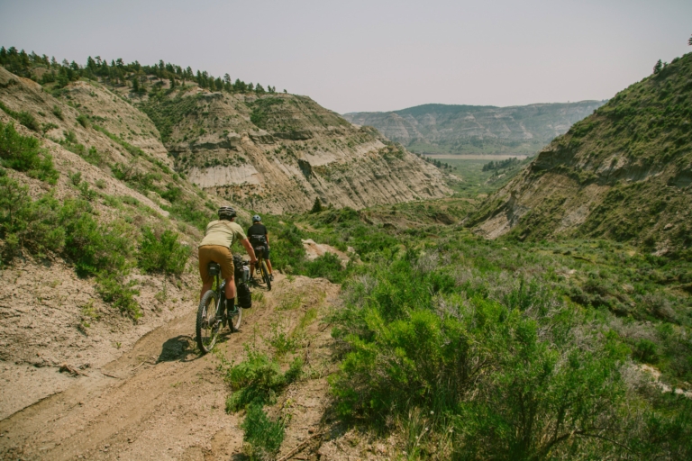
Plunging from the rolling prairies to the river, the Missouri Breaks is pure badlands country—and perfect terrain for the bighorn sheep who live among the hoodoos and precipitous hillsides. It’s less conducive to bicycles. Photo: Joel Caldwell
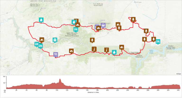
It takes a lot of pedaling to cover an effort as audacious as the American Prairie Reserve—359 miles and 17,990 vertical feet of pedaling, to be exact. You can follow the journey’s (literal) highs and lows, as well as see notable sights and stops along the way, with Bikepacking.com’s highly interactive map. See the detailed route and an extensive photo gallery on Bikepacking.com, with their full trip report available here. Map courtesy of Logan Watts/Bikepacking.com.
Day 0 | The Winifred Tavern
The front door of the Winifred Tavern is open, and a breeze flutters the layer of signed dollar bills hanging from the ceiling above a large wraparound bar. Photos of hunters posing with enormous bighorn sheep hang alongside antiquated, neon beer advertisements. Just over 200 people live in the town of Winifred, an agricultural community some ten miles south of the Missouri River, but the Winifred Tavern feels like a destination, a place you arrive at intentionally.
Which is exactly what my companions and I discuss from our barstool perches. Our team comes from across North America: Peter Hall is an architect living in Missoula, Montana, Jacques Boiteau is an engineer from Denver, Colorado and Logan Watts, founder of Bikepacking.com, lives in Brevard, North Carolina. Logan and I have ridden bikes together around the world, and he’s the brain behind our upcoming week of exploration, punishment, hilarity and joy.
Crouching over our beers, we catch up on each other’s lives and discuss the long ride ahead. Outside, the wind blows through the wide-open country and it begins to rain steadily. We settle in to wait.
Day 1 | An Imperfect Start
62 miles, 2,890 feet of climbing
Multiple friends warned me about the area’s infamous “gumbo mud,” a heavy mix of sand and clay that can encase an adult elk’s legs. “If it rains,” they’d said, “just camp and wait. Don’t try to ride.”
We should have waited longer.
It takes less than a mile to realize our folly, when Jacques’ red-mud-covered derailleur shifts into his spokes and shears off the hanger, leaving his bike completely inoperable. Peter doubles back for the van while Jacques assesses the situation. His chances of continuing are slim; to keep going, he must find a very specific part in one of the most remote areas of the continental United States. Even so, Jacques loads his broken bike into the van after Peter returns and sets off to find a fix. We continue pedaling.
Ten miles down a slick, muddy road, a local in a large pickup pulls over to inform us the McClelland-Stafford Ferry, our means of crossing the Missouri River, has been damaged by the spring ice-flow. Our only option is to slog to the next bridge, adding 50 miles to the day’s ride. The infuriating gumbo mess sticks to my drivetrain, cassette and tires. When I attempt to shift gears on the next short climb, I hear a dreadful “CHUNK!”—almost the same noise Jacques’ derailleur made a few hours earlier.
Luckily, the hanger is only bent, and as I wiggle it off the bike, a man astride an impossibly large motorcycle idles up alongside us. His name is Robin Hurd, and he owns a farm outside of Big Sandy, Montana. After we explain our situation, Hurd takes the hanger—a three-inch piece of steel—and confidently pounds it back into shape with two rocks. Farm-hand ingenuity at its finest.
I ask him what he thinks of the APR’s efforts. “I think it’s kind of cool,” he says. “It’s not like anybody has to sell. The only way they get the land is to buy it from someone. I don’t know why people are so worried about it.”
He stands up, triumphantly holding the now-straightened part. I’m down a gear, but my bike still works, and Hurd pulls two bottles of homebrew from his saddlebags to uplift our spirits.
The road dries out quickly and we pick up speed. Meadowlarks flit from fencepost to fencepost, their lilting song urging us onward, and we ride through clouds of butterflies for another 50 miles. It’s nearly sundown when we reconnect with our original route, and a friendly rancher named Steve Faber offers to let us pitch tents on his property, the Pinwheel Ranch, which abuts BLM land. As the sun sets over the Missouri, we find ourselves drinking beer for the second time that day, glad for sturdy steel, helpful locals, and—most of all—dry dirt.
Day 2 | The Breaks
36 miles, 2,798 feet of climbing
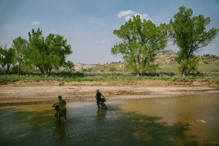
The Upper Missouri River Breaks National Monument is largely unchanged since Lewis and Clark first documented the region in 1805: wild, beautiful and brutal enough to break both man and machine. Photo: Joel Caldwell
The next morning we’re up early, riding along primitive two-tracks bordered by shin-deep grass. Mule deer flee at our approach, disappearing into thickets of dense pine. Within an hour we enter the lonely crags and canyons of the Missouri Breaks—or just “the Breaks,” to locals. As the prairie nears the Missouri River, the grassy plains “break away” into a succession of steep, rocky bluffs and outcroppings falling hundreds of vertical feet to the water below.
Lewis and Clark first saw the Breaks in spring of 1805, after sailing up the Missouri River from St. Louis. In his journals, Lewis described the white cliffs paralleling the watercourse as “a thousand grotesque figures, pyramids, and lofty, freestone buildings their parapets well-stocked with statuary. So perfect indeed are those walls that I should have thought that nature attempted here to rival the human art of masonry had I not recollected that she had first begun her work.”
The landscape is as beautiful as it is austere. And it is hot. Centuries of erosion have eaten away at the layers of sandstone, limestone, siltstone and shale, shaping them at varying rates into a stark badlands. Small ponds and streams are rimmed with a white mineral film leached from the ground. We spot a ribbon of smoke over the opposite canyon wall, but quickly shift our attention to the harrowing descent through crowds of bleached, alien-shaped hoodoos to the bottom.
A sandy gulch takes us across the canyon, and a few steep hike-a-bikes later we crest the rim to an old two-track. It’s an old stagecoach road, called “Bullwhacker” by locals, a remnant of a minor gold rush that swept through the area in 1900. But it’s the single-engine plane, crawling east across the clear sky, that draws our attention. It spits out a handful of tiny figures: smokejumpers, parachuting to the source of the smoke we saw earlier. Mud yesterday, fire today. Welcome to the Breaks.
Soon the two-track crumbles and disappears into a series of sunken gullies. Exhausted, we drag our bikes back up a hill “steeper than a cow’s face,” as a local later describes it, onto a grassy ridgeline. After a few hours of pedaling, we’re out of the Breaks.
Abused and nearly delirious, we round a corner to an unexpected greeting: Jacques, lounging against his bike. Between sweaty hugs and high-fives, he tells us how he found a similar hanger at a bike shop and was able to ground it down enough to do the trick. It’s a welcome reunion after a hard day’s ride.
Day 3 | Little Rocky Mountains, Zortman, Dry Fork
60 miles, 3,782 feet of climbing
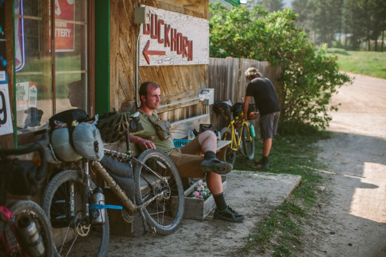
Our path through the Little Rockies spit us out into the Wild-West hamlet of Zortman, Montana, once a hangout for Butch Cassidy and the Sundance Kid. Peter Hall takes a seat at the Buckhorn Store, one of the town’s few businesses. Photo: Joel Caldwell
The trip’s biggest climb begins at the ghost town of Landusky, on an old mining road heading into the Little Rocky Mountains. The name, however, is a misnomer; the isolated range rises 2,500 vertical feet above the surrounding plains, and our route grinds straight up a loose, rocky hill before spitting us out in the tiny town of Zortman. It has a Wild West feel, as if a gunfight might break out at any moment—and, 120 years ago, they did. Landusky’s namesake, Powell “Pike” Landusky, was killed in a barroom shootout with the famous outlaw Harvey “Kid Curry” Logan in 1894. Both towns sprung up during a gold rush that swept through the Little Rockies in the late 1800s, during which an estimated $125 million in gold was taken out of the mountains. Now, only 60 year-round residents call Zortman home.
After a hot meal at the Miner Club Bar and a resupply at the Buckhorn Store, we coast down Highway 191 and turn east, past the stately white buildings of the Matador Ranch. While not part of APR, the Nature Conservancy bought the 60,000-acre property in 2000 and have since partnered with local ranchers to use it as a “grass bank.” Ranchers can graze their cattle on the Matador, but only if they agree to use wildlife-friendly practices on their own land.
The two-track grows fainter by the mile as we enter the Dry Fork unit of the Reserve, eventually disappearing in the grass along with any buildings, fences or signs of humanity. We ride on faith, cruising through undulating green hills turned golden by the setting sun. After two days in the Breaks and Little Rockies, we have finally arrived at the virgin, unplowed prairie lands of Montana’s Northern Great Plains—one of only four remaining tracts of temperate grassland suitable for ecosystem-scale conservation in the world.
Here, at this moment, I realize I’ve never properly experienced this ecosystem. As we set up camp, we are serenaded by the yelping of coyotes and the peculiar boom of nighthawks diving above. There are simply too many insects and birds to wonder at. A few pronghorn antelope stare curiously from atop the next rise. Those white-rumped, black-eyed ungulates are the fastest land animals on the continent, able to reach nearly 60 miles an hour—when not blocked by fences that hinder their migration patterns.
There is not a single fencepost in any direction. I am struck by the immensity, reassured by the complete absence of humanity. I sit back and let myself imagine pronghorns in the tens of thousands, herds of bison as far as the eye can see, even grizzly bears and wolves. But when I open my eyes the emptiness confronts me. It’s like touring the Louvre, devoid of all the art.
I sleep without my rainfly on a soft bed of grass.
Day 4 | White Rock, Wildlife, Waterfowl
63 miles, 1,400 feet of climbing
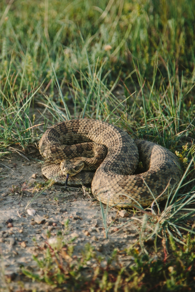
The vast herds of bison may be gone, but the American Prairie Reserve is still home to plenty of wildlife—some less cuddly than others, such as this rattlesnake sunning itself on the trail. Photo: Joel Caldwell
A tailwind pushes us down the prairie, past dilapidated homesteads that lean like drunkards along the roadside. Temperatures are soaring by the time we enter the Reserve’s White Rock unit, but after three days our heavily packed bikes have begun to feel more manageable.
As the hours pass, we encounter more wildlife than we’ve seen thus far. Pronghorn and mule deer approach us, engaging in inquisitive standoffs before flashing away into the grass. We spook a huge covey of blue grouse, the camouflaged birds erupting in noisy waves in front of our wheels. Lark buntings flutter up to deliver their songs. Osprey and hawks circle on thermals high above; below, long-billed curlews dash across the dry ground, calling loudly to warn us away from their nests. An avian symphony sings, calls and thrums, backed up by an orchestra of crickets.
We drift away to the overwhelming sound of life.
Day 5 | The American Bison
60 miles, 2,116 feet of climbing
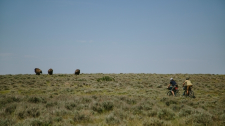
Today we see our first bison. From a distance, the herd just looks like dark spots on an otherwise green palette, but that’s an illusion; a single bull can top 2,000 pounds and stand over six feet tall. The species was only reintroduced to the APR in 2005, but over the past 15 years their numbers have grown from 16 to 849 (as of 2019).
Our first close encounter happens a few hours later, when we surprise two bison after topping a rise. The massive animals explode upward in a cloud of dust, jump twice and break into a gallop. They run through the prairie—the iconic American mammal at home in North America’s iconic landscape—for the first time in over a century.
We arrive at an APR campground on the Sun Prairie unit in the heat of the day and pedal a few miles south to the Enrico Education & Science Center. The center provides information for visitors and an office for researchers working on the Reserve. The large wraparound porch provides welcome shade for the midday recovery beers Peter and I had mailed ahead the week before.
Delirious with lunch, booze and five days of riding, we descend along the 201 Road into the Charlie M. Russell National Wildlife Refuge (CMR) which, along with the adjoining Upper Missouri Breaks National Monument (UMBNM), makes up the core of the APR’s conservation land. The CMR and UMBNM span a combined 1.478 million acres, stretched along nearly 275 miles of the Missouri River, and encompass the UL Bend Wilderness and 21 Wilderness Study Areas. Both are the ancestral lands of numerous native peoples, including the Assiniboine, Gros Ventre and Piegan Blackfeet. The Fort Belknap Indian Reservation—which has its own self-sustained herd of 300 bison—sits just north of the UMBNM.
The two areas represent something globally unique: an opportunity to see the same Great Northern Plains that Lewis and Clark described in their journals, if only on a smaller scale and without the megafauna. “In the whole project area, the prairie is 90-95% unplowed,” says Damien Austin, APR’s vice president and reserve superintendent. “The primary reason is that most of it was never settled, never altered. Huge chunks of it are public lands, [owned by the] BLM and state [of Montana].”
Our path splits a large prairie dog colony, where hundreds of furry heads watch us suspiciously. Despite their diminutive size, the critters are a key species in the prairie’s recovery. Their dens provide shelter for numerous other animals and habitat for insects, and the prairie dogs themselves are a foundational food source for predators of all sizes. We hear a cacophony of high-pitched warning barks from all directions. Then, as if we’ve crossed some imaginary line, the heads disappear, only to reappear a few moments after we’ve passed.
The next climb is a 45-minute slog, up three massive inclines on an old stagecoach road into the setting sun. Sweat dumps from every pore, attracting a cloud of mosquitos that keep pace as we grind towards the summit. Every time I swat at my leg my hand comes away dotted with bloody bug bodies, but I take grim satisfaction from the dozens ineffectually swarming my prosthetic leg. I drop my bike at our campsite and frantically change into full rain gear, desperate for any protection from the twilight swarm.
Day 6 | Charlie M. Russel
48 miles, 3,658 feet of climbing
Mercifully, the mosquitos have vanished in the night. We head out after breakfast and coffee, riding along the ridgeline before bombing down to the Missouri River and re-entering the CMR. Our path is forever westward, a rollercoaster of ascents and descents that wearies even our seasoned legs. The last climb puts us on the high bluffs overlooking the river’s south bank, and I stop for one final look at the Breaks. It nearly broke us six days earlier, but now brings waves of nostalgia.
Eventually the road takes us out of the CMR. We make camp on a small piece of public land 15 miles from Winifred, cooking over a smoky fire of dried sagebrush as nighthawks dance and dive overhead.
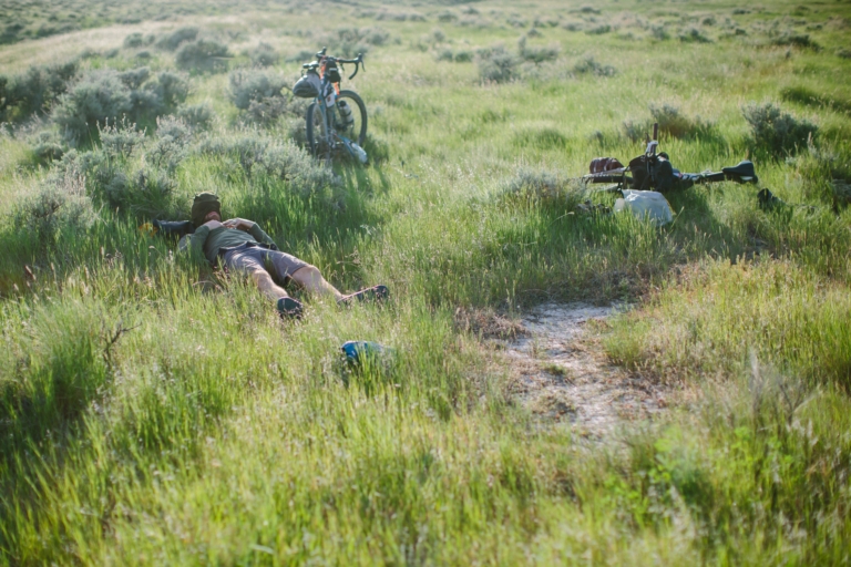
After six days, 320 miles and over 16,000 vertical feet of climbing, Jacques Boiteau was too beat to inflate his sleeping pad. Instead, he opted to take a nap in the soft prairie grass. Poto: Joel Caldwell
Day 7 | Back to Winifred
35 miles, 1,460 feet of climbing
By 10:30am we’re comfortably installed on four bar stools at the Winifred Tavern again, digging into omelets and burgers, our filthy clothes baggy from seven days of hard riding. I strike up a conversation with Ralph Rogers, a retired schoolteacher and trained wildlife biologist seated a few stools down. Like most people we’ve met over the past week, Ralph is friendly and direct. He displays a nuanced understanding of what hangs in the balance and an appreciation for the country in which he lives. But there is also a stubborn resistance to seeing it changed by those that he thinks of as outsiders. He’s reluctant to endorse the reserve, a sentiment that seems to stem from loyalty to this close-knit community.
“This little life at the end of the road here is really special,” he says. “Every rancher and farmer has a huge amount of pride in what they do. What a lot of people resent [about the APR] is the whole concept that this should be America’s playground. Why should they be the ones to sacrifice their way of life that has been unchanged forever?”
Of course, “forever” is a relative term; 200 years ago, there wasn’t a farm or ranch in the entire state. Yet when I mention the importance of protecting the grasslands ecosystem, Rogers is quick to agree. “Every inch of prairie needs to be preserved by someone, somewhere, because it’s all gone,” he says. He finishes with a dose of realism. “It can never be what it was.”
A week later, I have the opportunity to talk to Alison Fox, APR’s CEO. There are both setbacks and successes to discuss—in September of 2019, for example, APR purchased the 14,122-acre Blue Ridge Ranch but also learned that their state and federal bison grazing application had been reduced from 290,000 acres to 12,000 in response to pushback from farmers, ranchers and the state legislature. Fox, however, is most interested in hearing about my conversations with locals. When I mention Rogers’ comments, she agrees that no one should have to sacrifice. “We’re buying land from willing sellers, land that comes on the market,” she says. “We just have a different vision for how we would like to manage our land. We all have tremendous respect and love of this country—[it’s about] how we find that common ground.”
The author would like to give a big thanks to the staff at APR, Dan Flores and Sara Dant, and Prosthetics in Motion
